U. S. Environmental Protection Agency
Acequia Institute
The New Mexico Acequia Assocation
Rio Ruidoso Stream Flow - Upper Canyon (table)
Rio Ruidoso Stream Flow - Hollywood (table)
USGS - Water
Ditch and Reservoir Company Alliance
Watershed
"Watershed" is the term used to describe the geographic area of land that drains water to a shared destination. The water moves through a network of pathways, both underground and on the surface. Generally, these pathways converge into streams and rivers, which become progressively larger as the water moves downstream, joining other watersheds or basins. Because water moves downstream, any activity that affects the quality or quantity of water, or rate of movement at one location can affect other locations downstream. For this reason, it is imperative for everyone living or working within a watershed to cooperate to ensure that the watershed endures.
Description and Location
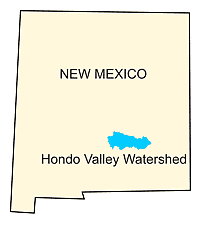
MAP OF NEW MEXICO
The Hondo Valley watershed, also known as the Rio Hondo Watershed, is a sub-basin of the Lower Pecos and is located in South-Central New Mexico. It is bordered by the Sacramento Mountains on the west, the Capitan Mountains on the North, and Pajarita Mountain on the south. As shown in the map below, 55% of the watershed is in Lincoln County, 12% is in the highlands of Otero County, and the remaining 33% is in downstream Chavez County. The Hondo Valley watershed drains its 1,076,480 acres (1,674 square miles) into the Pecos River near Roswell, New Mexico.
Topography

Hondo Valley Watershed
(click on images for larger size)
The following description of the topography of the Upper Hondo Watershed is
excerpted from Water Resources and Geology of the Rio Hondo Drainage Basin,
by Walter Mourant, 1961:"Relief in the Rio Hondo drainage basin ranges from an
almost level alluvial plain in the east to deeply dissected mountains in the
west. The altitude at the confluence of the Rio Hondo and the Pecos River is
3,445 feet; that of the Sierra Blanca peak in the western part of the basin is
12,003 feet.
Remnants of an ancient plain that probably extended through much of the region
can still be traced on high mesas in parts of the Hondo basin. This plain was
much higher and older than the alluvial terraces near the rivers. The upland
area west of the Pecos River alluvial plains is dissected deeply, especially at
high altitudes in the western part of the Rio Hondo Basin. The valleys are
U-shaped in the eastern and central part of the basin and are progressively
V-shaped in westward in the upland area. The mountainous areas consist of the
Capitan Mountains, the Sacramento Mountains, and Pajarita Mountain. The Capitan
Mountains, which rise about 4000 feet above the surrounding terrain, trend
east-west about 20 miles and form the northern boundary of the Hondo basin. The
altitude of the highest peak is 10,230 feet; the relief is sharp. Talus is
common on the steep slopes and an alluvial fan of rounded boulders has been
deposited around the flanks of the mountains. The Sacramento Mountains form a
long north-south rage, and a reach of about 15 miles of their crest forms the
west boundary of the Hondo basin. Sierra was glaciated during the Pleistocene
Epoch, and has a glacial cirque on its northeast slope. Parajita Mountain forms
the southern boundary and has an altitude of 8,014 feet.”